A much larger island
Plan west, central and east as distinct experiences.
Grand Bahama stretches roughly 96 miles east to west. West End is the strategic base for Tiger Beach; Freeport and Lucaya hold the broadest dining, lodging and dive infrastructure; the east opens into pine forest, mangroves, caves and Gold Rock Beach.
A brief history
Lucayan communities predated European arrival and were destroyed by enslavement and forced removal. The modern city of Freeport grew after the 1955 Hawksbill Creek Agreement created a free-trade and industrial zone. Hurricane Dorian’s catastrophic 2019 landfall still informs the island’s recovery and resilience.
What it is most known for
Tiger Beach, open-ocean dolphin programs, reef and wreck diving, Lucayan National Park, Gold Rock Beach, Freeport and the marinas of West End and Lucaya.
Geography
The island sits between the shallow Little Bahama Bank and deep Atlantic water. Low limestone, extensive caves, pine forest and mangrove wetlands make the landscape more varied than its resort reputation suggests.
Map & orientation
West End → Freeport & Lucaya → East End.
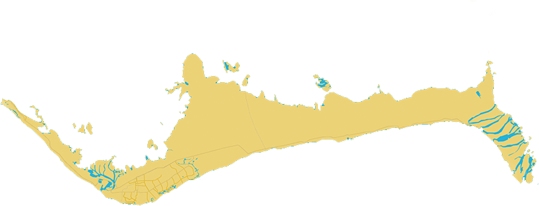
Tiger Beach boats leave the west. Freeport and Lucaya hold most services. Lucayan National Park and Gold Rock Beach lie east.
Map: Bahamas Ministry of TourismPlan your trip
Winter favors comfortable exploration; dive operators set their own shark calendars.
December–February
Lower humidity and comfortable temperatures suit beaches, parks and town days. Cold fronts can create wind and boat cancellations.
March–May
Spring balances warmer water with generally pleasant conditions. Tiger Beach seasons differ by operator, so verify the exact annual program.
June–August
July brings warm water, Goombay celebrations, high humidity and increasing tropical-weather and sargassum risk.
September–November
The quietest stretch overlaps peak storm risk. Use flexible reservations and leave margins around ferry, flight and boat days.
Is Grand Bahama hurricane-safe?
No. The island suffered catastrophic impacts from Hurricane Dorian in 2019. Choose flexible bookings and named-storm coverage.
Getting there & ferries
Fly to Freeport—or cross from Florida.
Grand Bahama International Airport (FPO)
Freeport is the main gateway. Lucaya is the convenient central base; West End is about a 40–60 minute road transfer depending on pickup and conditions.
Fort Lauderdale → Freeport
Baleària Caribbean publishes Port Everglades–Grand Bahama crossings of roughly three hours. A passport is required; confirm sailing date, terminal, luggage limits and check-in deadline.
No dependable Grand Bahama ↔ Bimini tourist ferry
Both islands connect independently with Fort Lauderdale, but not by a reliable daily passenger route to each other. Use a verified domestic flight or connect through Fort Lauderdale or Nassau.
Where to stay
Stay near the experience you came for.
Best for Tiger Beach
West End
Shortest departure logic for offshore shark days and a quiet marina rhythm, with limited restaurant choice.
- Consider
- Old Bahama Bay and nearby rentals
Best for first visits
Lucaya & Freeport
The broadest dining, lodging, beach and operator choice, plus easier airport access.
- Consider
- Pelican Bay, Lighthouse Pointe, Viva Fortuna and apartments
Best for nature & quiet
East Grand Bahama
Closer to Lucayan National Park and undeveloped coast. A car is essential; verify current services.
- Consider
- Small eco-stays and vacation homes
Long, pale and uncrowded
Beaches worth building a day around.
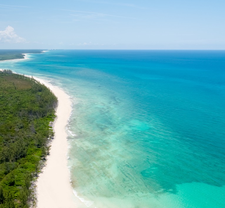
Gold Rock Beach
Lucayan National Park’s cinematic wild beach, most dramatic near low tide when broad sand flats appear. Bring water, shade and insect repellent and confirm park access.
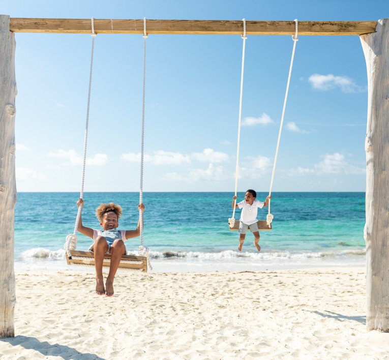
Taino Beach
A broad, easy-access beach near Lucaya with food nearby and a social feel. The Wednesday fish fry at Smith’s Point adds an easy evening.
Fortune Beach
A long, comparatively quiet strand east of Lucaya, well suited to an unhurried lunch and swim when the sea is settled.
Paradise Cove
A small west-side beach and snorkeling base beside Deadman’s Reef. Take the local briefing before swimming out; tide and wind matter.
The southern coast carries the greatest exposure
Checked July 29, 2026
Regional monitoring shows an exceptionally active 2026 sargassum season. Grand Bahama’s long southern shoreline—including parts of Gold Rock, Fortune, Taino and Lucaya—can receive landings when wind and current push material across the northern Bahamas. Conditions vary considerably along the island and can change after a wind shift or cleanup.
The experiences people book first
Grand Bahama’s most worthwhile tours and day trips.
The strongest outings reveal the island’s underwater life, limestone caves, mangroves and fishing grounds while adapting to weather and wildlife.
Tiger Beach expedition
Travel offshore with a specialist operator for a carefully managed encounter with tiger, lemon and Caribbean reef sharks. Remote-water safety and operator discipline matter.
Lucayan National Park
Walk the cave boardwalk, learn about the island’s limestone systems and continue to Gold Rock Beach near low tide.
Open-ocean dolphin program
Join UNEXSO’s managed program with resident Atlantic bottlenose dolphins and review the current participation and welfare details before booking.
Mangrove kayak tour
Paddle sheltered creeks with a naturalist while looking for turtles, rays, juvenile fish and birdlife among the mangroves.
Deadman’s Reef snorkel
Swim from Paradise Cove toward an established reef area after a local briefing on wind, tide, entry points and distance.
Deep-sea fishing charter
Target wahoo, mahi-mahi, tuna, billfish and other pelagics with a licensed captain who understands current seasons and conditions.
The defining experience
Tiger Beach deserves its own planning page.
Diving Grand Bahama
The complete diving page covers tiger-shark protocols, West End logistics, day boats versus liveaboards, weather buffers, certification, remote-water safety, wrecks, reefs and dolphin programs.
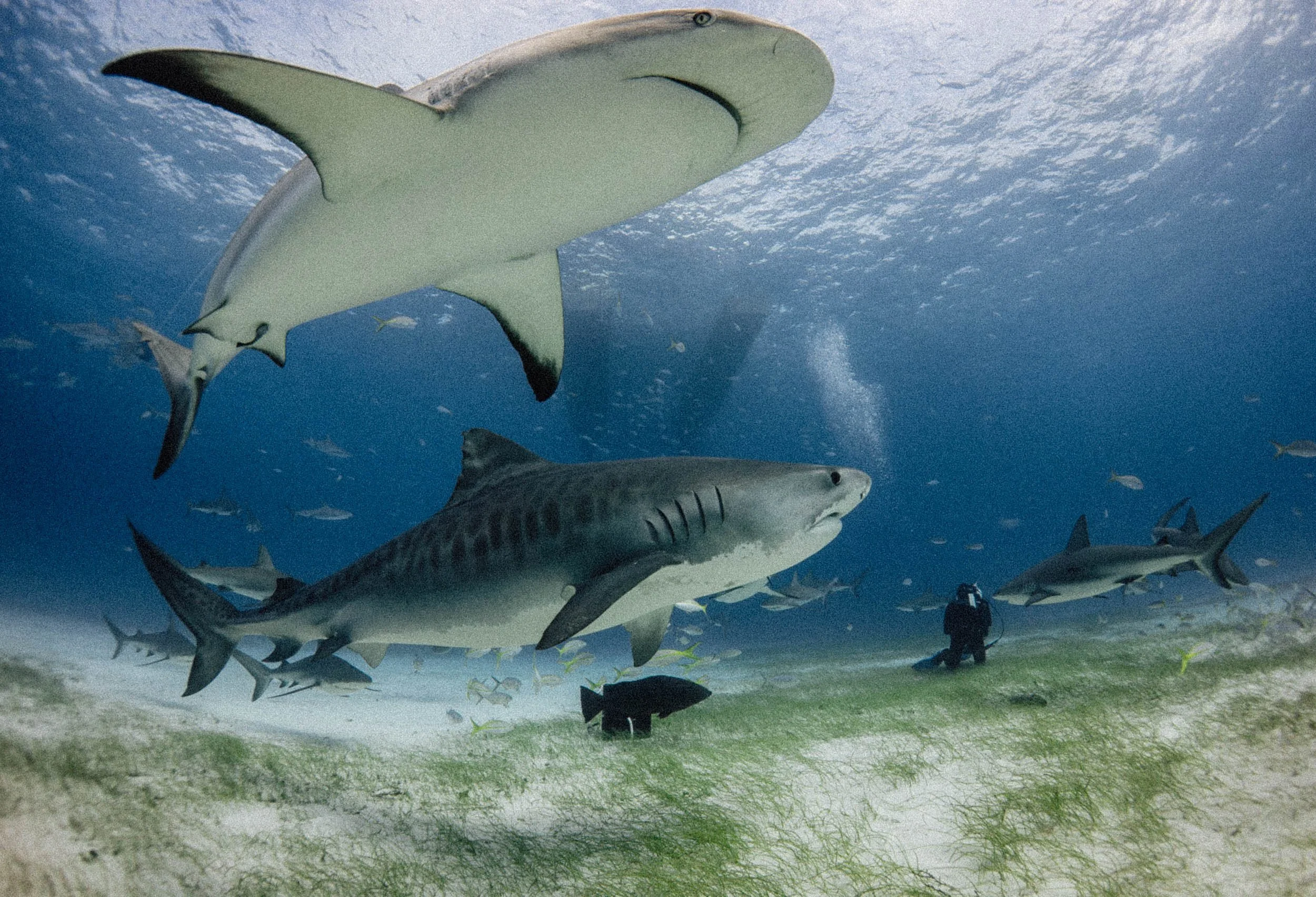
The shallow site still demands strong operator protocols, disciplined positioning and a plan for remote-water emergencies.
Bimini Scuba Center · official operator mediaOn & under the water
A full dive catalog beyond the tigers.
Deep-sea fishing
Grand Bahama offers real offshore fishing from Port Lucaya, Freeport and West End. The edge of the Little Bahama Bank and nearby Gulf Stream water can hold wahoo, mahi-mahi, tuna, sailfish, blue marlin and swordfish. Charter availability is strongest around the main marinas.
Best timing: Wahoo is usually the cooler-season headline, mahi and tuna often strengthen in spring, and billfish are possible as water warms. West End provides quick access to deep water but remains exposed to fronts and Gulf Stream conditions.
Wrecks & reefs
Theo’s Wreck, Sea Star, Papa Doc and Rainbow Reef offer different depths and marine life. Site condition and moorings change, so let a local operator match the day to your experience.
Dolphin programs
UNEXSO offers managed open-ocean programs with trained resident Atlantic bottlenose dolphins. This is a structured encounter; read current welfare and participation details before deciding whether it suits you.
Snorkeling & paddling
Deadman’s Reef is a recognized snorkel base. Guided mangrove kayaks reveal juvenile fish, turtles, rays and birdlife in calmer water.
Sailing & surfing
West End and Lucaya provide useful marina infrastructure for longer passages and locally operated boat days. Surf is occasional and storm-dependent, so plan the trip around Grand Bahama’s diving, fishing and nature.
Nature & culture
Go beyond Freeport’s resort edge.
Lucayan National Park
Walk the cave boardwalk, then cross to Gold Rock Beach near low tide for the island’s most cinematic shoreline.
Mangrove kayak
Paddle sheltered creeks with a naturalist for birds, turtles, rays and nursery habitat.
Garden of the Groves
A gentle garden walk with waterfalls, native plants and birdlife—best early before the heat builds.
Smith’s Point fish fry
Pair grilled fish and conch with music beside Taino Beach; confirm the current weekly night.
Cave-diving boundary
Ben’s Cave access is controlled, while Owl’s Hole and other submerged systems are advanced overhead environments. Never enter beyond open-water limits without cave-specific training, permission and qualified local leadership.
The annual calendar
Goombay summer and Junkanoo nights.
Selected summer dates
Grand Bahama Goombay Summer Festival
A waterfront celebration of Bahamian music, food, craft and dance.Boxing Day & New Year season
Junkanoo
Community parades layer goatskin drums, cowbells, brass and elaborate costumes.Restaurants & hotels
Use Lucaya for variety; plan West End dinners.
Flying Fish GastroBar, Sabor and the wider Lucaya restaurant district; verify current openings
The weekly fish-fry tradition near Taino Beach for grilled seafood, conch and music
Marina restaurants and limited nearby options—confirm service before a full-day shark trip
Old Bahama Bay for West End; Pelican Bay and resort choices around Lucaya; smaller rentals farther east
Practical details
The useful things to know before you go.
Bahamian English and local expressions shape everyday conversation.
BSD is fixed at parity with the U.S. dollar. U.S. cash is accepted throughout the island.
Cards work at larger businesses. Carry small cash outside central Freeport, for tips and during outages.
North American plugs fit the standard outlets.
Supply and plumbing vary. Filtered or bottled water is the conservative choice.
A rental car is useful for West End, the national park and beaches beyond Lucaya.
Transportation
Rent a car for West End, Lucayan National Park and eastern beaches. Arrange late, ferry-terminal and dive-day transfers in advance.
Entry basics
Entry rules depend on nationality and arrival method. Ferry passengers need a passport and must meet the carrier’s check-in deadline; private vessels must complete current Bahamas customs and immigration procedures.
Safety
Follow current advisories and use reputable transport and marine operators. Remote boat travel, heat and long road distances deserve planning.
Health & vaccines
Keep routine vaccines current, use mosquito and sun protection and carry insurance that covers diving and evacuation.
Ferry schedules, shark programs, park access, customs procedures and business hours change. Reconfirm details with official sources and your providers before travel.
Research desk
Official sources & live checks
Ferry days, dive programs, park access and recovery conditions change. Start here, then verify directly for your travel week.